
TSA8 Survey Equipment
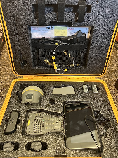
Trimble survey equipment is available for use by any of the TSA8 districts. There are two units available for use, a northern unit and southern unit. Click the link below to find the current location of either equipment unit.
About the equipment...
The southern unit:
-
Trimble R10-2 (The device that attaches to pole to take measurements)
-
Trimble TSC7 (Handheld controller that connects to the R10-2)
The northern unit:
-
Trimble R12i Model Base and Rover Mode (The device that attaches to the pole to take measurements)
-
Trimble TSC7 (Handheld controller that connects to the R12i)
Helpful links for equipment use
See below for a summary YouTube video of importing/export Survey GPS points in/out of ArcPro from today's training:
Other Helpful links:
Lidar:
Statewide DEM (Add data from path for this one):
https://g46prsaddst01.blob.core.windows.net/mntopo/dem_100k/2nd_Generation_Seamless_Lidar_DEM.vrt
USGS Link to download DEMs:
https://apps.nationalmap.gov/lidar-explorer/#/
Other GIS Youtube Videos:
Points to/from GPS:
https://www.youtube.com/watch?v=SEF0sTm_qaU
Creating Pts Layer in ArcPro for Use in Field Maps:
https://www.youtube.com/watch?v=cu7Z29MB5is
Maps by Mitch YouTube channel:
https://www.youtube.com/@mapsbymitch7467
Imagery (Add as a WMS and paste in the link....I used the Beltrami Aerial from 2023 for today's training...it is under the regional dropdown):
Need assistance?
Call
Mike Becker, Morrison SWCD
(320) 631-3557
Mitch Brinks, Maps By Mitch
(218) 820-9502
Patrick Schulz, BWSR
Training Engineer
(218) 340-1632